ABSTRACTStudents learn how to test hypotheses related to the local, regional, and continental determinants of local breeding bird species richness, using georeferenced data from standardized point counts and remotely-sensed data, including orthoimages and continental-scale land use and land cover. The exercise is intended as a small-group bounded inquiry. The activity requires a short period of in-class introduction and time for student presentations, but completion of the exercise can be done outside of class.
AUTHORSTom A. Langen1 1- Departments of Biology & Psychology, Clarkson University, Potsdam NY 13699-5805 USA; tlangen@clarkson.edu CLASS TIME2 to 3 hours. This includes 30 - 45 minutes for an introduction to the activity, 10 minute check-in sessions on each of two subsequent class periods, and one hour for presentations. Time for presentations depends on class size: each 3-5 person team will do a 7 to 10 minute presentation. OUTSIDE OF CLASS TIME5 hours or more per student. The per-student time varies, depending on how well organized teams are and how skilled students are with figuring out unfamiliar computer applications. Allow 2 weeks to complete the out-of-class component of the activity. STUDENT PRODUCTSEach student-team submits a worksheet that has a scaffolded set of questions about the exercise. Each team also provides a data table and four graphs that summarize their data collection and analysis. The team makes an oral presentation about their data analysis and conclusions, and they submit the powerpoint slide set as a product. SETTINGNorth America, using publically-available data accessed from the internet; patch-scale to landscape-scale data for land use / land cover and species richness. COURSE CONTEXTUndergraduate ecology, class of 30 students INSTITUTIONSmall 4-year primarily-undergraduate institution TRANSFERABILITYA simplified version of this activity may be appropriate for non-majors or high-school students. The activity is also appropriate for upper-division (junior/senior) undergraduates. The exercise is suitable for most students, including those who cannot easily go into the field. The only students for whom this activity may not be suitable are the visually-impaired. DOWNLOADSDescription of other Resource Files:
ACKNOWLEDGMENTSThis has been developed as part of the Teaching with Large Datasets Distributed Seminar, which was a collaboration among NCEAS, ESA, and NEON Inc, with support from NSF. Special thanks Teresa Mourad (ESA), Wendy Graham (NEON Inc.), Stephanie Hampton (NCEAS), Amelia Nuding (NCEAS), Bruce Grant (Widener University) and all of the active collaborators within our working-group, especially Barbara Abraham (Hampton University) and Denny FernŠndez (University of Puerto Rico at Humacao). My undergraduate students Tiyi Brewster and Rachael Rodriguez provided a perceptive analysis and critique of the exercise. CITATIONTom A. Langen. 26 April 2012, posting date. Drivers of Avian Local Species Richness: Continental-Scale Gradients, Regional Landscape, or Local Land Cover?Teaching Issues and Experiments in Ecology, Vol. 8: Experiment #2 [online]. http://tiee.esa.org/vol/v8/experiments/langen/abstract.html |

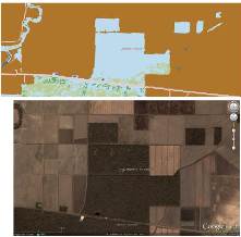
Land cover near the point countís location (source: 2006 National Land Cover Data), and a matching high-resolution image of the point count location (source: Google Earth). full size image |
<top> | |